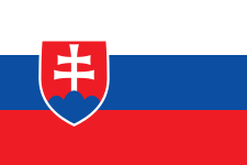
 On the Slovakian flag there is a double cross on top of the middle one of three blue mountains. Where can this cross be found? The middle mountain is Krivan (2494m/P400) and on the summit there is such a cross and consequently Krivan is known as Slovakia's national mountain
  |
| Krivan's summit cross |
See http://en.wikipedia.org/wiki/%C5%A0trbsk%C3%A9_Pleso_-_%C5%A0trba_rack_railway


This time I left Strbske Pleso on the red marked track that goes north-west skirting the pleso/lake itself and then through the forested area - or what is left of the forest after the February 2004 Tatranska Bora (katabatic wind) and the subsequent bark beetle infection. Large areas of the forest were devastated in a period of two hours as the wind smashed its way through.
 |
| Krivan from the west -with evidence of the Tatranska Bora still showing |
 |
| Krivan from the south |
Being Slovakia's national mountain I expected it to be more crowded than it was. That could be partly because it is is of less interest to the Poles and partly because I had set out quite late.
The view from the summit was great. The only problem was that I realised that my water bottle was empty and I was thirsty.
 |
| Britain's national symbol meets the Slovakian one - laterally. |
 |
| Looking east from Krivan summit |
Most of the bars/restaurants in the resort close at 7.00 pm, so it was a bit of a struggle to find one that was still open and have a beer, which is extremely cheap in Slovakia. Quite literally, beer is cheaper than water in the shops and bars.
When I got on the 8.00 pm train I realised I had left my wallet in the bar - it was a mad dash there and back and I only just managed to get back on it in time. The train was full - full of tired, sunburned, sweaty but happy walkers of all ages - a few I recognised as having met earlier in the day and on previous days.
No comments:
Post a Comment