 |
| Wilder Kaiser, indeed |
20-10-12

What a magnificent sight is Wilder Kaiser with its highest
point of Ellmauer Halt (2344m P1552 i.e.
an Ultra). It is a range of hills in the Kaisergebirge Alps that just seems to
soar up out of the earth. You can see it for kilometres around. There was no
way that I could just drive past it and ignore it.
 Nursing my hangover, I parked up in St. Johann in Tirol with
the intention of getting a non-alcoholic drink and wandering around to see if
there was a bookshop that sold maps. Not
sure if the day was just an ordinary day or a festival, but it was buzzing with
activity There were market stalls around the quaint Tyrolean buildings.
Nursing my hangover, I parked up in St. Johann in Tirol with
the intention of getting a non-alcoholic drink and wandering around to see if
there was a bookshop that sold maps. Not
sure if the day was just an ordinary day or a festival, but it was buzzing with
activity There were market stalls around the quaint Tyrolean buildings.
I couldn’t
see a bookshop, but by chance I found a
remainder shop selling outdated Kompass maps for only four Euros. Oh, bliss
upon bliss. Let me explain if you are
not a hilbagger, or even a hillwalker (a different animal altogether) that is
like a gourmand accidentally discovering a four star restaurant giving food
away for free. I mean, how can a map of a mountain become outdated,
geologically speaking?
Next day, with a very early start for me, I set off as
daylight broke from the parkplatz at
Wochenbrunner Alm (1084m) up an unpaved road to Gaudeamushutte (1263m). This
was the point where I became momentarily confused, the map said take track 813,
the signs only offered 824.That’s how a map of a mountain can become outdated.
 |
| The first obstacle |
The next section of the track has to overcome the obstacle of getting up a cliff on to Gruttenkopf – none too hard, but not
really a tourist path.
 On the top was the, closed for winter, Gruttenhutte and
the start of track 813 on both map and signs. The track starts innocently
enough on the grassy alp.
On the top was the, closed for winter, Gruttenhutte and
the start of track 813 on both map and signs. The track starts innocently
enough on the grassy alp.  | |||||
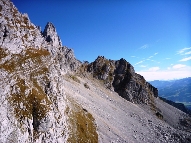
However it soon enters into a rock strewn corrie with
a small glacier in the bottom and magnificent views of the almost vertical
sided main ridge.
How on earth will the track take me up there?

 |
| Glacier from above |
 The answer to that question was by means of a series of
kletterstieg assisted climbs and some long traverses across the rock.
The answer to that question was by means of a series of
kletterstieg assisted climbs and some long traverses across the rock.
One section consisted of steel rings forming a long ladder –
see picture – I assume they are set so high because in winter they are
above the snow . This ladder was fine going up, but I wasn’t too keen coming
back down it.
 |
| Onwards and upwards |

 Near the summit is a small hut precariously lodged into the
rock in a very exposed position. You wouldn’t want to step outside half-asleep during the night for a pee.
Near the summit is a small hut precariously lodged into the
rock in a very exposed position. You wouldn’t want to step outside half-asleep during the night for a pee. |
| Ellmauer Halt summit |
 |
| Starting down agaiin |
 |
| Here's the bit I didn't like going down |
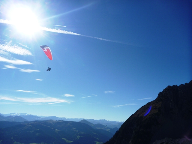 |
| Icarus? |
The return route as far as the Gruttenhutte was very much
the same as the ascent, although I took the possibility of missing out some of
the rocks lower down by running down the scree and walking across the glacier.
As it was a Saturday and glorious weather,
now there were a lot of people on the paths that cross the alp. I
discovered later that it is also half-term in Germany which explained the
numbers of children.
From the Gruttenkopf I used the alternative track 825 (812 on
my map) back to Wockenbrunner Alm. This was a bit easier than the ascent path.
Back at the van, I celebrated bagging the Wilder Kaiser with a bottle of Kaiser
beer and then went for a meal and a couple glasses of weissbier at the very
busy alm, sharing a table with a friendly family from Frankfurt.
 |
| After the weissbeer |

No comments:
Post a Comment