Translate

Saturday 26 July 2014

Albanian Maja e Jezercěs

Hoxha bunker
Albanian drivers must be amongst the worst - I bet they think a Hollywood car chase is tame. However the frequent traffic police along the main roads seem only interested in whether vehicles lights are on, in line with the policy of dipped headlights at all times. I had only driven a short distance from the border (where there were none of the usual traffic regulations signs) when I was stopped. The traffic policeman started writing out a ticket. However, near Podgorica, I had picked up two Polish students hitching around eastern Europe. They managed to speak to the
officer and when he realised their nationality the ticket was torn up. Just goes to show it is useful to have a Pole handy.


As for the cliché that all Albanians drive Mercedes, it is not quite true. Some drive Audis instead.


Most of the road signs seemed to be full of bulletholes like this one at Boge
I spent the night in Boge, a tiny village along a narrow road on the way to Thethi. Like most roads in Albania there were many, sometimes very large, potholes. I parked up alongside a bar, that had a 'kamping' sign, run by a delightful woman. She managed to rustle up a very cheap, but more than ample, meal very quickly. She understood the English words for no and eat, but not meat. With a bit of sign language and pointing to a cow that had wandered into her garden I thought she understood until a large and vicious looking sausage appeared on the plate.
Or barely legible like this pointing to Thethi

Maja e Jezercěs P2036 2694m is part of the considerable barrier that helped Albania be cut off from the rest of the world for many years, especially when communist dictator Hoxha was in charge. Apparently one of the things he did was order the building of 750000 concrete bunkers that were never used and nearly crippled the economy.
Just getting to the start point at Thethi is a challenge. However EU funding for a paved road will probably make it a lot easier in a year or so. I ended up relying on a ride on a minibus to negotiate the currently treacherous road, apparently made worse by bikers.

The driver insisted I get out at Jimmy Guri's place. Jimmy gave me his card stating that he was the Director/Manager of Theti Park. (see www.Thethipark.com) and introduced me to the local chief of police (he was more interested in telling me the superiority of Munchen Bayern over Manchester Utd). Jimmy has a broad American accent acquired from living in the Us after escapinbg from Albania during the breakdown of communism in Yugoslavia in 1989. Jimmy turned out be extremely helpful to the extent that he loaned me some money to pay for the jeep ride back to Boge as I missed the last minibus of the day. Nearly all my cash, in Euros, had been spent on getting a Green card at the border and had cost me a lot more than I expected.
From Jimmy's there was a good track down to the dry river bed below. Turn left at N42.41735 E19.75605 and cross the wide almost waterless river bed to a Hoxha bunker at  N42.41962 E19.75834 (870m). From there the trail is waymarked and follows the river bed through pines to the foot of the vertical wall that surrounds the valley. There is a way up, obviously. It goes past a giant overhang which provides a perfect spot for a bivvy and then emerges on a flattish 'alp' called Qala e Paja N42.44265 E19.77027 (1668m). The painted waymarks are replaced by occasional small cairns. I continued along the ridge as far as N42.44146 E19.77900 and set up camp for the night. Whilst I was putting the tent up a passing shepherd indicated there was a much bigger area for camping further on and lower down. However,  I had already had a look down there and spotted several herds of sheep each accompanied by Barling dogs. I had heard the reputation of these Albanian sheep dogs and did not fancy getting any nearer.


Typical Hoxha bunker - at least this one is useful as a trail marker. Only 749999 to find.

Imagine this is a raging torrent and difficult to cross after snow melts.


There is a way up there.

Next morning I followed the cairns around the edge of the large sinkhole being used by the shepherds and up onto the steep rocky slopes of the mountain which forms a giant cirque around the first part of the ascent. As there are many steep crags it is essential to keep to the path, especially on the way back down (I managed to lose the way on descent and had to retreat back uphill when faced with a near vertical cliff with no obvious way down). The route twists and turns a number of times before you get a view of the summit; I had speculated on various false summits before spotting the whereabouts of the true one hidden in a cloud. Eventually the route comes out on the narrow ridge of the cirque at N42.44368 E19.80844. From there it is a combination of walking along narrow talus filled terraces and scrambling up and over large (sometimes exposed) rocks, some of which are a bit crumbly so that handholds come away. The summit is marked with a cross and abox containing a visitor's book. Judging by the entries in the book this mountain does not get a lot of visitors and definitely not English speaking ones.
My descent route varied a bit when near the sheep, I collected my tent and made my way back to Jimmy's. When crossing the dried up river bed I missed the track and ended up walking through a large meadow into a garden, where a mother and daughter were stood. I must have been a strange sight, jabbering in a strange language about how to get to the unpaved road. Without hesitation, though, the daughter ran to a spring in the garden, filled a bottle with water and presented it me. A lovely gesture.


Qala e Paja


Summit cross


Took me a while to remove enough stones for comfort 

Wednesday 16 July 2014

Crna Gora high point

Crna Gora or Montenegro highest point is in Durmitor national park - Bobotov Kuk 2523m P1480 N43.12815 E19.03475

Details will follow - one day!


Veliki Vitao - here be dragons

Having done Maglic I wanted to climb to the highest point on the range of mountains it is part of. This range, the Bioč, lies mainly in Montenegro and is clearly not often frequented - certainly not by English speaking people. I could very little online about the range or its highpoint, Velki Vitao, other than it was possible to get there from Stabna.


Stabna

Friendly people live here

Look for this sign when driving from Pluznice
Almost by chance, I ended up at the end of a narrow road with no turning point. Whilst I was struggling to reverse back downhill a man came out of the final house to help. He insisted that I came into his house and his wife insisted that I have some breakfast - consisting of caz (herbal tea) and bread with home-made kajmak (sour cream).I turned down the offer of a shot of slivovice which the man and his friend were drinking quite heavily for their breakfast. Their daughter was staying for a few days and she spoke excellent English. There was a big debate as to how I could get up the hill.
As it turned out the start of a path was opposite the house - however there is no signpost or markings. Indeed, there does not appear to be any marked trails anywhere on the range other than at the Trnovacko jezero or Maglic end.
Meadow
The path is very well defined through the woods and along a ridge overlooking the Stabanska river until it reaches a large alp or meadow. There were several ruined summer houses up there - only one seemed to be occupied by an old shepherd, with one tooth, who wanted to shake my hand. From thereon there were occasional animal or shepherd tracks that would show promise for a while and then fade.


The Bioč is a complex and large range. In a way, thankfully, I made a bit of a mistake and headed for the wrong summit. I say thankfully because if I had headed directly to the correct one I would probably not found the way over the intervening ridge. For anyone who is interested I can provide them with the GPS track showing the route I took - however, for both my ascent and descent routes I would suggest that they use the track as a rough guide rather than a definite plan to follow.
As it happens, the wrong summit was on the western end of the aforementioned intervening ridge and it was not toodifficult to drop down to a col and up to the true summit. If I had attempted to cross the ridge at any other point I would have ended up looking down a very steep and extended drop and would have given up. From the summit it was possible to see a pass at the eastern end that looked relatively easy. Even when I reached this pass the route back to the meadow was not as straighforward as I had naively imagined.
That gap is not a way through - view from north side

Anyone who wants to try for the summit in a roughly similar way to my descent route I list the crucial co-ordinates below. How you get between them is up to you. Mind you, I suspect any route will end up as convoluted and lengthy as mine because of the frequent need to go round the ubiquitous sinkholes, terraces and escarpments to be found in Karst limestone areas.
Start point (park about 80m before here): N43.17331 E18.75615.
End of clear path to meadow: N43.18214 E18.74882
Pass over intervening ridge: N43.20610 E18.76688 (From here, on a clear day you can see the summit)
Veliki Vitao summit: N43.22566 E18.75734

Whatever you do not head for the obvious steep sided notch in the intervening ridge instead of the pass I have indicated. There is no descent route on the other side. Other than that the walking is not too difficult

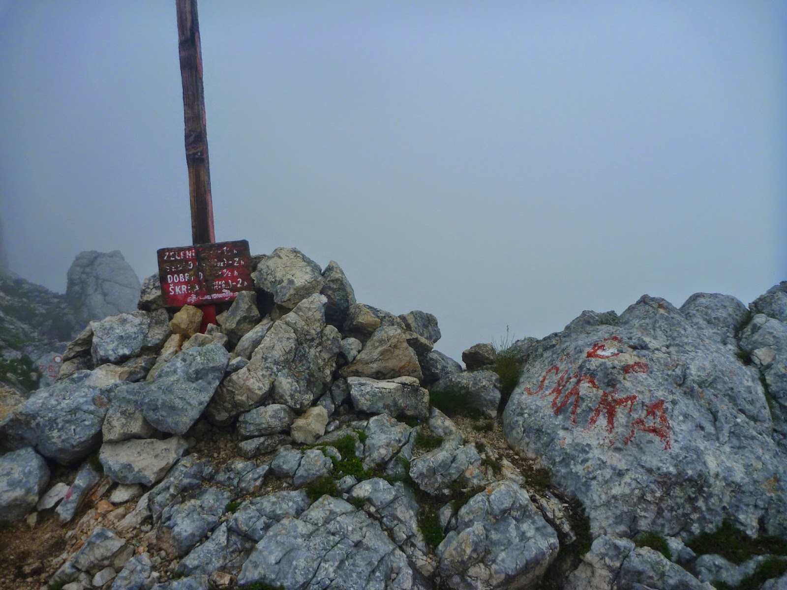
There is a visitor book on the summit - and the number of entries are rather few. However it is worth a visit the views are terrific


Believe in Maglic


Would you just drive in there?

I did not want to drive the long way round to the Bosnian side, especially without a Green card and the poor road up to the usual trailhead. So I wanted to see if it was possible to tackle Maglic, Bosnia i Hercegovina highest point (2386m P311) from over the border in Montenegro. I gave myself an afternoon to explore as I could not find any information online, certainly not in English. The village of Mratinje seemed the best option. Finding the village was the first task. The road to it has quite an uninviting start through a tunnel near a large hydro-electric dam at N43.27403 E18.84241.

Trailhead sign near Mratinje
Just before the village sign there is a right turn (N43.25907 E18.82458) into a rough, but drivable, back road into Bosnia. I spent a couple of hours walking up it to a pass on the first ridge. However the trailhead for Maglic is through the village at N43.26974 E18.78515 where there is a small parking space and a sign. Furthermore, there is a clearly marked trail 811 for the Trnovacko jezero (lake) and Maglic.


The road soon ends at a small hamlet. Then there is a steep path through a meadow into the trees. The path continues across a small scree slope and then to the foot of a much larger and flowery scree slope which is relatively easy to ascend at one side. When I got to the top there was a thunderstorm. Luckily I found a small bivvy sized cave where I dozed off until the storm passed by.


From there the landscape was one of karst limestone with the usual need to go round sinkholes of various sizes, past a voda (water) spring until reaching a ridge where the Trnovacko jezero path turned left and the path for Maglic turned right. From the ridge there were good views down into the next valley and into Bosnia.


The path went along the ridge and over various false summits until finally there was a view of the fine looking final summit which promised a brief scramble after crossing the international border marked by a EU development sign (despite neither country being a member - I bet this would have been an irritation for the Nigel Farage types). The top N43.28109 E18.73311 is marked with a metal Yugoslavian flag and a plaque in honour of Tito.

White Maglic

Yugoslavian flag

Tito plaque

Bosnia
 
I returned by the same route as I ascended. As I reached the trees there was another and lengthy thunder storm and I ended up very wet from torrential rain.


Friday 11 July 2014

Dubrovnik and Podgorica

City break time. On the way down, I made brief visit to Zagreb, Croatia's capital and had a quick look at the sights. Enjoyed a visit to the gallery of Naive Art, in particular.

Patrick whizzing around the city walls. 

In the second week of July 2014 I met up with my pal, Patrick, and we spent several days in Dubrovnik and a couple of days in Podgorica, Montenegro's capital. 


My son, Luke, was on his way to a music festival on one of the Croatian islands, so we also spent 24 hours with him in Dubrovnik. Dubrovnik being a resort was crowded, however enjoyed looking around the Old Town and the city walls. 
Patrick at rest


And then taking the cable car to the fortress on top of Srd and seeing the exhibition there of the photos showing the destruction and damage Dubrovnik received during the seige in 1991.


In terms of bagging that week it was limited to the highest point, Polacica (214m P214) on the island of Lopud.
Polacica summit 
Although only a short climb it turned out to be remarkably difficult trying to clamber over sharp karst limestone through close-planted trees and plentiful trailing plants covered in thorns. By time I got  back to the trail to the nearby fortress my arms were lacerated and bleeding and I washed off the blood with a sea swim.


Lopud


Montenegro is noticeably less affluent than Croatia. Crossing the border was not as difficult as I had anticipated as getting a Green card was quite simple. I hope it is as easy at forthcoming borders to other countries outwith the EU and no Schengen agreement. There seemed to be quite a large length of road in 'no-mans-land'.
Kotor bay 

Podgorica turned out be rather less attractive and uncharacteristically wet, with a lot of continuous heavy rain. If I say that possibly the most interesting experience was seeing a car back into the side of another one the reader may get the picture. The town used to be called Titograd and there is much evidence of the utilitarian style (or lack of style) of the Communist era.

Miljanov 's current view of Titograd

Marko Miljanov


Medun in the foothills of  the Kuci tribal area was more interesting. We were shown around the birthplace and burial place of  Marko Miljanov, national hero/ poet, who lead battles against the Turks in the late 19th century.